
Thank you for supporting this site ❤️
Make a donation
Make a donation
Gear up for your next adventure:
As an Amazon Associate, this site earns from qualifying purchases at no extra cost to you.
Vauladray topographic map
Click on the map to display elevation.
Thank you for supporting this site ❤️
Make a donation
Make a donation
Gear up for your next adventure:
As an Amazon Associate, this site earns from qualifying purchases at no extra cost to you.
About this map
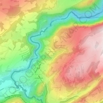
Name: Vauladray topographic map, elevation, terrain.
Location: Vauladray, Les Brenets, Le Locle, Neuchâtel, 2416, Suisse (47.05671 6.69455 47.09671 6.73455)
Average elevation: 3,097 ft
Minimum elevation: 2,280 ft
Maximum elevation: 3,901 ft
Thank you for supporting this site ❤️
Make a donation
Make a donation
Gear up for your next adventure:
As an Amazon Associate, this site earns from qualifying purchases at no extra cost to you.