
Thank you for supporting this site ❤️
Make a donation
Make a donation
Gear up for your next adventure:
As an Amazon Associate, this site earns from qualifying purchases at no extra cost to you.
Réclère topographic map
Click on the map to display elevation.
Thank you for supporting this site ❤️
Make a donation
Make a donation
Gear up for your next adventure:
As an Amazon Associate, this site earns from qualifying purchases at no extra cost to you.
About this map
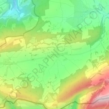
Name: Réclère topographic map, elevation, terrain.
Location: Réclère, Haute-Ajoie, District de Porrentruy, Jura, 2912, Suisse (47.35563 6.90200 47.39563 6.94200)
Average elevation: 2,041 ft
Minimum elevation: 1,417 ft
Maximum elevation: 2,920 ft
Thank you for supporting this site ❤️
Make a donation
Make a donation
Gear up for your next adventure:
As an Amazon Associate, this site earns from qualifying purchases at no extra cost to you.