
Thank you for supporting this site ❤️
Make a donation
Make a donation
Gear up for your next adventure:
As an Amazon Associate, this site earns from qualifying purchases at no extra cost to you.
s'Horta topographic map
Click on the map to display elevation.
Thank you for supporting this site ❤️
Make a donation
Make a donation
Gear up for your next adventure:
As an Amazon Associate, this site earns from qualifying purchases at no extra cost to you.
About this map
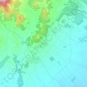
Name: s'Horta topographic map, elevation, terrain.
Location: s'Horta, Felanitx, Migjorn, Îles Baléares, 07669, Espagne (39.38771 3.18905 39.42771 3.22905)
Average elevation: 315 ft
Minimum elevation: 95 ft
Maximum elevation: 1,194 ft
Thank you for supporting this site ❤️
Make a donation
Make a donation
Gear up for your next adventure:
As an Amazon Associate, this site earns from qualifying purchases at no extra cost to you.