Geolocate

Scott topographic map

Click on the map to display elevation.

About this map

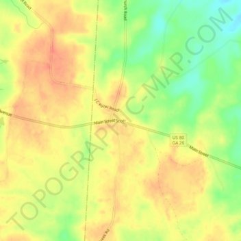
Name: Scott topographic map, elevation, terrain.

Location: Scott, Johnson County, Georgia, United States (32.53183 -82.68680 32.57183 -82.64680)

Average elevation: 341 ft

Minimum elevation: 246 ft

Maximum elevation: 400 ft

Johnson County trails, hiking, mountain biking, running and outdoor activities

Gear up for your next adventure:

🛰️Satellite Messengers - Emergency SOS and two-way messaging for off-grid adventures
🧥Men's Rain Shells - Premium waterproof and breathable jackets for mountain weather
🪓Survival Multi‑Tool - Versatile tool for camp and trail tasks
🧭Map Reading Tools - Tools and kits for map navigation
🔋Rechargeable Batteries - Power up your outdoor devices

As an Amazon Associate, this site earns from qualifying purchases at no extra cost to you.