
Carl Junction topographic map
Click on the map to display elevation.
About this map
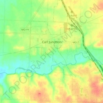
Name: Carl Junction topographic map, elevation, terrain.
Location: Carl Junction, Jasper County, Missouri, 64834, United States (37.14311 -94.57994 37.19947 -94.50997)
Average elevation: 906 ft
Minimum elevation: 827 ft
Maximum elevation: 981 ft
Jasper County trails, hiking, mountain biking, running and outdoor activities
Other topographic maps
Click on a map to view its topography, its elevation and its terrain.