
Thank you for supporting this site ❤️
Make a donation
Make a donation
Gear up for your next adventure:
As an Amazon Associate, this site earns from qualifying purchases at no extra cost to you.
Laayoune topographic map
Click on the map to display elevation.
Thank you for supporting this site ❤️
Make a donation
Make a donation
Gear up for your next adventure:
As an Amazon Associate, this site earns from qualifying purchases at no extra cost to you.
About this map
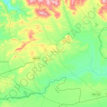
Name: Laayoune topographic map, elevation, terrain.
Location: Laayoune, Khemisti District, Tissemsilt, Algeria (35.54209 1.94885 35.79460 2.28952)
Average elevation: 2,933 ft
Minimum elevation: 2,267 ft
Maximum elevation: 4,551 ft
Thank you for supporting this site ❤️
Make a donation
Make a donation
Gear up for your next adventure:
As an Amazon Associate, this site earns from qualifying purchases at no extra cost to you.