Geolocate

Albion topographic map

Click on the map to display elevation.

About this map

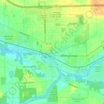
Name: Albion topographic map, elevation, terrain.

Location: Albion, Calhoun County, Michigan, 49224, United States (42.23076 -84.78256 42.26567 -84.73303)

Average elevation: 978 ft

Minimum elevation: 928 ft

Maximum elevation: 1,047 ft

Calhoun County trails, hiking, mountain biking, running and outdoor activities

Other topographic maps

Click on a map to view its topography, its elevation and its terrain.

Gear up for your next adventure:

🛌Ultralight Sleeping Bags - Compact down bags for cold nights in the wilderness
🔪Outdoor Multitools - Essential survival tools for gear repair and field use
🧯Portable Fire Pit - Compact fire pit for camping spots
🔦Powerful Headlamps - Ultra-bright hands-free lighting for night navigation
🧺Microfiber Travel Towels - Compact and fast-drying towels for trail use

As an Amazon Associate, this site earns from qualifying purchases at no extra cost to you.