Geolocate

Larissa topographic map

Click on the map to display elevation.

About this map
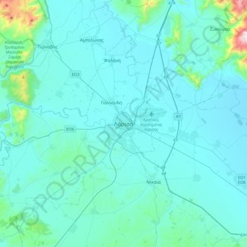
Name: Larissa topographic map, elevation, terrain.

Location: Larissa, Municipal Unit of Larissa, Municipality of Larissa, Larisa Regional Unit, Thessaly, Thessaly and Central Greece, 422 22, Greece (39.47831 22.25607 39.79831 22.57607)

Average elevation: 420 ft

Minimum elevation: 154 ft

Maximum elevation: 3,520 ft

Other topographic maps

Click on a map to view its topography, its elevation and its terrain.

Elassona Municipality

Greece > Thessaly > Larisa Regional Unit

Its geography includes farmlands in the valley areas, the mountains to the west and east and forests in the west and east as well as grasslands, ledges are to be founded in some areas and barren area in the higher elevations.

Average elevation: 2,113 ft

Gear up for your next adventure:

🦟Ultrasonic Repellers - Create a bug-free zone at your camp or rest stop
❄️Traction Cleats - Prevent slips on icy trails during winter hikes
🖼️Topo Map Wall Art - Decorative topographic prints of famous peaks and regions
🧣Hiking Neck Gaiter - Multi‑use neck protection for outdoor weather
🧴Hand Sanitizer - Keep hands clean while hiking

As an Amazon Associate, this site earns from qualifying purchases at no extra cost to you.