
Thank you for supporting this site ❤️
Make a donation
Make a donation
Gear up for your next adventure:
As an Amazon Associate, this site earns from qualifying purchases at no extra cost to you.
Teuchitlán topographic map
Click on the map to display elevation.
Thank you for supporting this site ❤️
Make a donation
Make a donation
Gear up for your next adventure:
As an Amazon Associate, this site earns from qualifying purchases at no extra cost to you.
About this map
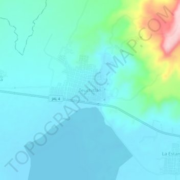
Name: Teuchitlán topographic map, elevation, terrain.
Location: Teuchitlán, Región Valles, Jalisco, 46760, Mexico (20.64372 -103.88727 20.72372 -103.80727)
Average elevation: 4,318 ft
Minimum elevation: 4,117 ft
Maximum elevation: 5,131 ft
Thank you for supporting this site ❤️
Make a donation
Make a donation
Gear up for your next adventure:
As an Amazon Associate, this site earns from qualifying purchases at no extra cost to you.