
Thank you for supporting this site ❤️
Make a donation
Make a donation
Gear up for your next adventure:
As an Amazon Associate, this site earns from qualifying purchases at no extra cost to you.
Ghriss topographic map
Click on the map to display elevation.
Thank you for supporting this site ❤️
Make a donation
Make a donation
Gear up for your next adventure:
As an Amazon Associate, this site earns from qualifying purchases at no extra cost to you.
About this map
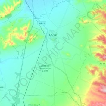
Name: Ghriss topographic map, elevation, terrain.
Location: Ghriss, Ghriss District, Mascara, 29006, Algeria (35.15444 0.10251 35.29388 0.26810)
Average elevation: 1,772 ft
Minimum elevation: 1,532 ft
Maximum elevation: 2,631 ft
Thank you for supporting this site ❤️
Make a donation
Make a donation
Gear up for your next adventure:
As an Amazon Associate, this site earns from qualifying purchases at no extra cost to you.