
Thank you for supporting this site ❤️
Make a donation
Make a donation
Gear up for your next adventure:
As an Amazon Associate, this site earns from qualifying purchases at no extra cost to you.
Uchuya topographic map
Click on the map to display elevation.
Thank you for supporting this site ❤️
Make a donation
Make a donation
Gear up for your next adventure:
As an Amazon Associate, this site earns from qualifying purchases at no extra cost to you.
About this map
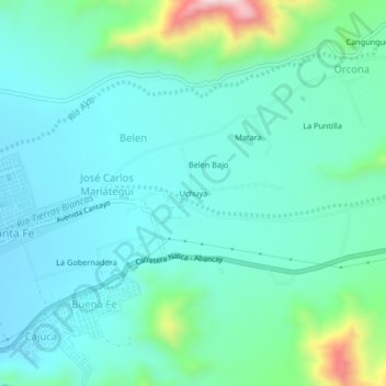
Name: Uchuya topographic map, elevation, terrain.
Location: Uchuya, Cantayo, Nasca, Ica, 11401, Perú (-14.84423 -74.93045 -14.80423 -74.89045)
Average elevation: 2,254 ft
Minimum elevation: 1,959 ft
Maximum elevation: 3,488 ft
Thank you for supporting this site ❤️
Make a donation
Make a donation
Gear up for your next adventure:
As an Amazon Associate, this site earns from qualifying purchases at no extra cost to you.