Geolocate

Gairo topographic map

Click on the map to display elevation.

About this map

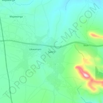
Name: Gairo topographic map, elevation, terrain.

Location: Gairo, Morogoro Region, Coastal Zone, Tanzania (-6.18027 36.82907 -6.10027 36.90907)

Average elevation: 4,232 ft

Minimum elevation: 3,832 ft

Maximum elevation: 5,755 ft

Other topographic maps

Click on a map to view its topography, its elevation and its terrain.

Kilombero

Tanzania > Morogoro Region

Average elevation: 1,562 ft

Kilosa

Tanzania > Morogoro Region

Average elevation: 2,730 ft

Ulanga

Tanzania > Morogoro Region

Average elevation: 1,496 ft

Mvomero

Tanzania > Morogoro Region

Average elevation: 1,857 ft

Mikumi National Park

Tanzania > Morogoro Region

Average elevation: 1,870 ft

Ulanga

Tanzania > Morogoro Region

Average elevation: 1,496 ft

Gear up for your next adventure:

🔌Solar Panel Charger - Charge gear sustainably outdoors
🌧️Backpack Rain Cover - Keep gear dry in wet weather
🔋Solar Power Banks - Keep your GPS and phone charged in remote wilderness areas
🔌USB Car Charger - Car charger for on‑the‑go power needs
🔦Powerful Headlamps - Ultra-bright hands-free lighting for night navigation

As an Amazon Associate, this site earns from qualifying purchases at no extra cost to you.