Geolocate

Haochong topographic map

Click on the map to display elevation.

About this map

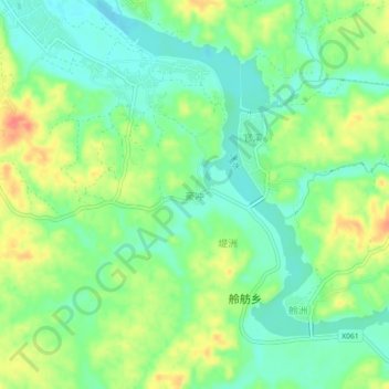
Name: Haochong topographic map, elevation, terrain.

Location: Haochong, Chaling County, Zhuzhou, Hunan, China (26.71627 113.58834 26.75627 113.62834)

Average elevation: 420 ft

Minimum elevation: 344 ft

Maximum elevation: 541 ft

Gear up for your next adventure:

📶Satellite Messenger - Communication device off‑grid
🏫Relief Map Kits - Hands-on tools for teaching landforms and elevation
🌧️Backpack Rain Cover - Keep gear dry in wet weather
🧭Outdoor Navigation Book - Learn advanced navigation skills
🛠️Backpacking Tool Kit - Essential toolkit for outdoor repairs

As an Amazon Associate, this site earns from qualifying purchases at no extra cost to you.