Geolocate

Melvold topographic map

Click on the map to display elevation.

About this map

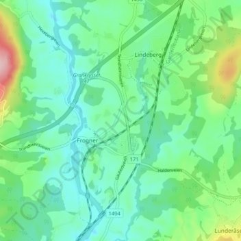
Name: Melvold topographic map, elevation, terrain.

Location: Melvold, Frogner, Lillestrøm, Akershus, 2016, Norway (60.00784 11.09341 60.04784 11.13341)

Average elevation: 472 ft

Minimum elevation: 325 ft

Maximum elevation: 922 ft

Gear up for your next adventure:

🔦LED Headlamp - Bright and durable LED headlamp for night navigation
🔥Plasma Lighters - Windproof lighters that work in any weather condition
👟Men's Trail Runners - Lightweight footwear for fast-paced exploration and light hiking
🧭Outdoor Navigation Book - Learn advanced navigation skills
Backpacking Tents - Weight-optimized shelters for multi-day topographic surveys

As an Amazon Associate, this site earns from qualifying purchases at no extra cost to you.