
Thank you for supporting this site ❤️
Make a donation
Make a donation
Gear up for your next adventure:
As an Amazon Associate, this site earns from qualifying purchases at no extra cost to you.
Azeffoun topographic map
Click on the map to display elevation.
Thank you for supporting this site ❤️
Make a donation
Make a donation
Gear up for your next adventure:
As an Amazon Associate, this site earns from qualifying purchases at no extra cost to you.
About this map
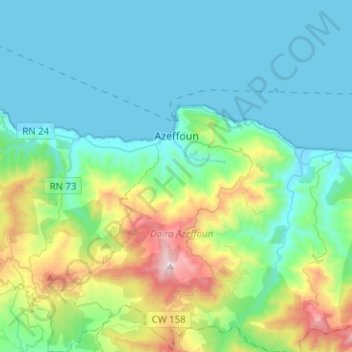
Name: Azeffoun topographic map, elevation, terrain.
Location: Azeffoun, Azeffoun District, Tizi Ouzou, 15045, Algeria (36.82918 4.26278 36.91074 4.51367)
Average elevation: 846 ft
Minimum elevation: -7 ft
Maximum elevation: 4,131 ft
Thank you for supporting this site ❤️
Make a donation
Make a donation
Gear up for your next adventure:
As an Amazon Associate, this site earns from qualifying purchases at no extra cost to you.