
Thank you for supporting this site ❤️
Make a donation
Make a donation
Gear up for your next adventure:
As an Amazon Associate, this site earns from qualifying purchases at no extra cost to you.
Llangadog topographic map
Click on the map to display elevation.
Thank you for supporting this site ❤️
Make a donation
Make a donation
Gear up for your next adventure:
As an Amazon Associate, this site earns from qualifying purchases at no extra cost to you.
About this map
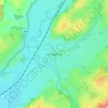
Name: Llangadog topographic map, elevation, terrain.
Location: Llangadog, Carmarthenshire, Wales, SA19 9AH, United Kingdom (51.91797 -3.90376 51.95797 -3.86376)
Average elevation: 213 ft
Minimum elevation: 112 ft
Maximum elevation: 541 ft
Thank you for supporting this site ❤️
Make a donation
Make a donation
Gear up for your next adventure:
As an Amazon Associate, this site earns from qualifying purchases at no extra cost to you.