Geolocate

Chawton topographic map

Click on the map to display elevation.

About this map

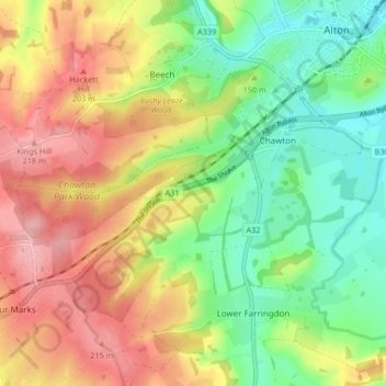
Name: Chawton topographic map, elevation, terrain.

Location: Chawton, East Hampshire, Hampshire, England, United Kingdom (51.11487 -1.04853 51.13860 -0.96513)

Average elevation: 515 ft

Minimum elevation: 325 ft

Maximum elevation: 735 ft

Gear up for your next adventure:

🏕️Tent Footprint - Protect your tent base from wear
🦶Carbon Trekking Poles - Reduce knee impact on steep descents with ultra-light poles
🛠️Backpacking Tool Kit - Essential toolkit for outdoor repairs
🔌Solar Panel Charger - Charge gear sustainably outdoors
🧥Waterproof Jacket for Hiking - Breathable and rugged rain jacket for outdoor excursions

As an Amazon Associate, this site earns from qualifying purchases at no extra cost to you.