Geolocate

Rockwell topographic map

Click on the map to display elevation.

About this map

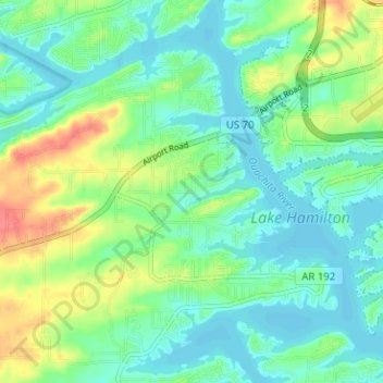
Name: Rockwell topographic map, elevation, terrain.

Location: Rockwell, Garland County, Arkansas, United States (34.44231 -93.17037 34.48442 -93.10722)

Average elevation: 453 ft

Minimum elevation: 394 ft

Maximum elevation: 591 ft

Garland County trails, hiking, mountain biking, running and outdoor activities

Gear up for your next adventure:

⛑️Personal Locator Beacon - Safety beacon for emergencies
🧤Hiking Gloves - Protective gloves for rugged trails
🛏️Cold Weather Sleeping Bag - Warm sleeping bag for cold conditions
🪵Folding Camp Saw - Compact saw for wood and campsite work
🪶Thermal Camp Blanket - Extra warmth for cold nights

As an Amazon Associate, this site earns from qualifying purchases at no extra cost to you.