
Thank you for supporting this site ❤️
Make a donation
Make a donation
Gear up for your next adventure:
As an Amazon Associate, this site earns from qualifying purchases at no extra cost to you.
Ankoli topographic map
Click on the map to display elevation.
Thank you for supporting this site ❤️
Make a donation
Make a donation
Gear up for your next adventure:
As an Amazon Associate, this site earns from qualifying purchases at no extra cost to you.
About this map
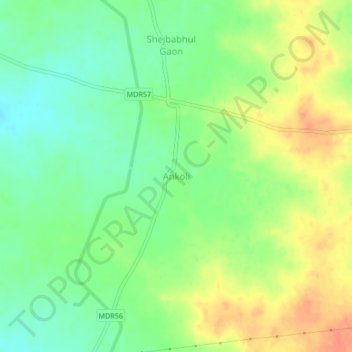
Name: Ankoli topographic map, elevation, terrain.
Location: Ankoli, Mohol, Solapur, Maharashtra, 413245, India (17.65138 75.58898 17.69138 75.62898)
Average elevation: 1,572 ft
Minimum elevation: 1,503 ft
Maximum elevation: 1,654 ft
Thank you for supporting this site ❤️
Make a donation
Make a donation
Gear up for your next adventure:
As an Amazon Associate, this site earns from qualifying purchases at no extra cost to you.