Geolocate

Dobhi topographic map

Interactive map

Click on the map to display elevation.

About this map

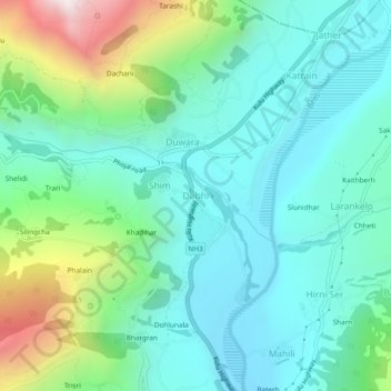
Name: Dobhi topographic map, elevation, terrain.

Location: Dobhi, Kullu, Kullu District, Himachal Pradesh, 175128, India (32.07151 77.10587 32.11151 77.14587)

Average elevation: 5,564 ft

Minimum elevation: 4,508 ft

Maximum elevation: 8,852 ft

Other topographic maps

Click on a map to view its topography, its elevation and its terrain.

Tiun

India > Himachal Pradesh > Kullu

Tiun, Kullu, Kullu District, Himachal Pradesh, India

Average elevation: 8,934 ft

Kalga

India > Himachal Pradesh > Kullu > Pulga

Kalga, Pulga, Kullu, Himachal Pradesh, India

Average elevation: 8,602 ft

Rudgranag

India > Himachal Pradesh > Kullu

Rudgranag, Kullu, Himachal Pradesh, India

Average elevation: 10,072 ft

Brahman Koti

India > Himachal Pradesh > Kullu > Naggar

Brahman Koti, Naggar, Kullu, Himachal Pradesh, 175130, India

Average elevation: 5,820 ft

Bhuntar

India > Himachal Pradesh > Kullu

Bhuntar, Kullu, Kullu District, Himachal Pradesh, 175126, India

Average elevation: 5,115 ft

Goj

India > Himachal Pradesh > Kullu > Manikaran

Goj, Manikaran, Kullu, Himachal Pradesh, 175105, India

Average elevation: 7,139 ft

Shat

India > Himachal Pradesh > Kullu > Shat

Shat, Kullu, Himachal Pradesh, India

Average elevation: 5,673 ft

Tosh

India > Himachal Pradesh > Kullu > Tosh

Tosh, Kullu, Himachal Pradesh, India

Average elevation: 8,891 ft