
Make a donation
Gear up for your next adventure:
As an Amazon Associate, this site earns from qualifying purchases at no extra cost to you.
Züschen topographic map
Click on the map to display elevation.
Make a donation
Gear up for your next adventure:
As an Amazon Associate, this site earns from qualifying purchases at no extra cost to you.
Züschen
Züschen liegt im nordöstlichen Rothaargebirge rund 7 km südöstlich von Winterberg und knapp 7 km nordwestlich von Hallenberg. Es breitet sich zwischen 450 und 816 m Höhe im Tal der Nuhne (ein Eder-Zufluss) aus, die in Züschen durch den Zusammenlauf von Sonneborn und Ahre entsteht. Durch den Ort verläuft die B 236.
Make a donation
Gear up for your next adventure:
As an Amazon Associate, this site earns from qualifying purchases at no extra cost to you.
About this map
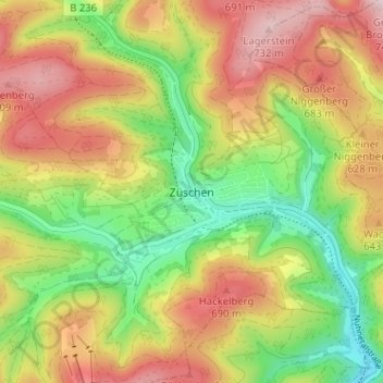
Name: Züschen topographic map, elevation, terrain.
Average elevation: 1,916 ft
Minimum elevation: 1,430 ft
Maximum elevation: 2,431 ft
Make a donation
Gear up for your next adventure:
As an Amazon Associate, this site earns from qualifying purchases at no extra cost to you.