
Concord topographic map
Click on the map to display elevation.
About this map
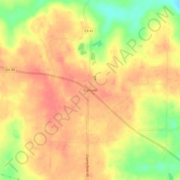
Name: Concord topographic map, elevation, terrain.
Location: Concord, Sumter County, Georgia, United States (32.12016 -84.40130 32.16016 -84.36130)
Average elevation: 495 ft
Minimum elevation: 361 ft
Maximum elevation: 564 ft
Sumter County trails, hiking, mountain biking, running and outdoor activities
Other topographic maps
Click on a map to view its topography, its elevation and its terrain.