
Thank you for supporting this site ❤️
Make a donation
Make a donation
Gear up for your next adventure:
As an Amazon Associate, this site earns from qualifying purchases at no extra cost to you.
Sanctorum topographic map
Click on the map to display elevation.
Thank you for supporting this site ❤️
Make a donation
Make a donation
Gear up for your next adventure:
As an Amazon Associate, this site earns from qualifying purchases at no extra cost to you.
About this map
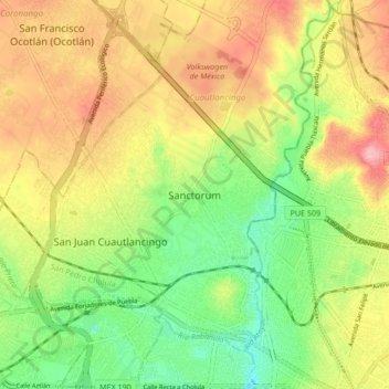
Name: Sanctorum topographic map, elevation, terrain.
Location: Sanctorum, Cuautlancingo, Puebla, 72730, México (19.05917 -98.29417 19.13917 -98.21417)
Average elevation: 7,100 ft
Minimum elevation: 6,877 ft
Maximum elevation: 7,346 ft
Thank you for supporting this site ❤️
Make a donation
Make a donation
Gear up for your next adventure:
As an Amazon Associate, this site earns from qualifying purchases at no extra cost to you.