
Thank you for supporting this site ❤️
Make a donation
Make a donation
Gear up for your next adventure:
As an Amazon Associate, this site earns from qualifying purchases at no extra cost to you.
Goldbach topographic map
Click on the map to display elevation.
Thank you for supporting this site ❤️
Make a donation
Make a donation
Gear up for your next adventure:
As an Amazon Associate, this site earns from qualifying purchases at no extra cost to you.
About this map
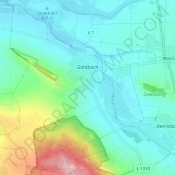
Name: Goldbach topographic map, elevation, terrain.
Location: Goldbach, Nessetal, Landkreis Gotha, Thüringen, Deutschland (50.96677 10.62618 51.01018 10.67774)
Average elevation: 984 ft
Minimum elevation: 850 ft
Maximum elevation: 1,450 ft
Thank you for supporting this site ❤️
Make a donation
Make a donation
Gear up for your next adventure:
As an Amazon Associate, this site earns from qualifying purchases at no extra cost to you.