
Thank you for supporting this site ❤️
Make a donation
Make a donation
Gear up for your next adventure:
As an Amazon Associate, this site earns from qualifying purchases at no extra cost to you.
Losenstein topographic map
Click on the map to display elevation.
Thank you for supporting this site ❤️
Make a donation
Make a donation
Gear up for your next adventure:
As an Amazon Associate, this site earns from qualifying purchases at no extra cost to you.
About this map
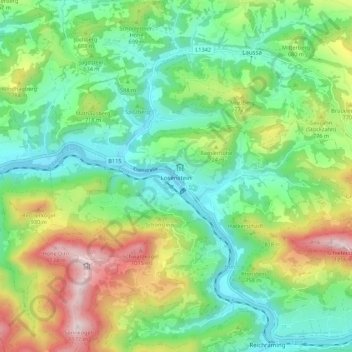
Name: Losenstein topographic map, elevation, terrain.
Location: Losenstein, Bezirk Steyr-Land, Upper Austria, 4460, Austria (47.90604 14.38327 47.94653 14.49199)
Average elevation: 1,985 ft
Minimum elevation: 1,083 ft
Maximum elevation: 3,848 ft
Thank you for supporting this site ❤️
Make a donation
Make a donation
Gear up for your next adventure:
As an Amazon Associate, this site earns from qualifying purchases at no extra cost to you.