Geolocate

Tawain topographic map

Click on the map to display elevation.

About this map

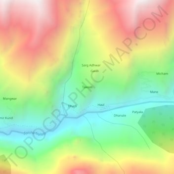
Name: Tawain topographic map, elevation, terrain.

Location: Tawain, Pangi, Chamba District, Himachal Pradesh, India (32.96707 76.48334 33.00707 76.52334)

Average elevation: 10,348 ft

Minimum elevation: 7,943 ft

Maximum elevation: 13,291 ft

Gear up for your next adventure:

🧭Compass with Lanyard - Easy‑carry compass for navigation
🦶Hiking Gaiters - Keep debris and water out of your boots
❄️Traction Cleats - Prevent slips on icy trails during winter hikes
🧭Orienteering Set - Complete compass and map reading kit
🧭Pro Hiking Compasses - High-accuracy liquid-filled compasses for topographic orientation

As an Amazon Associate, this site earns from qualifying purchases at no extra cost to you.