
Make a donation
Gear up for your next adventure:
As an Amazon Associate, this site earns from qualifying purchases at no extra cost to you.
Gongala topographic map
Click on the map to display elevation.
Make a donation
Gear up for your next adventure:
As an Amazon Associate, this site earns from qualifying purchases at no extra cost to you.
Gongala
Gongala is a mountain in the Ratnapura District of Sri Lanka. At a summit elevation of 1,358 m (4,455 ft), it is the 15th tallest mountain in Sri Lanka.
Make a donation
Gear up for your next adventure:
As an Amazon Associate, this site earns from qualifying purchases at no extra cost to you.
About this map
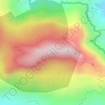
Name: Gongala topographic map, elevation, terrain.
Average elevation: 3,366 ft
Minimum elevation: 2,178 ft
Maximum elevation: 4,373 ft
Make a donation
Gear up for your next adventure:
As an Amazon Associate, this site earns from qualifying purchases at no extra cost to you.
Other topographic maps
Click on a map to view its topography, its elevation and its terrain.