
Thank you for supporting this site ❤️
Make a donation
Make a donation
Gear up for your next adventure:
As an Amazon Associate, this site earns from qualifying purchases at no extra cost to you.
Wapi Pathum topographic map
Click on the map to display elevation.
Thank you for supporting this site ❤️
Make a donation
Make a donation
Gear up for your next adventure:
As an Amazon Associate, this site earns from qualifying purchases at no extra cost to you.
About this map
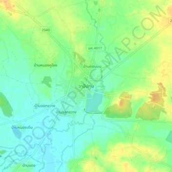
Name: Wapi Pathum topographic map, elevation, terrain.
Location: Wapi Pathum, Lin Fa, Maha Sarakham Province, Thailand (15.80288 103.34000 15.88288 103.42000)
Average elevation: 479 ft
Minimum elevation: 443 ft
Maximum elevation: 535 ft
Thank you for supporting this site ❤️
Make a donation
Make a donation
Gear up for your next adventure:
As an Amazon Associate, this site earns from qualifying purchases at no extra cost to you.