Pico Almanzor topographic map
Interactive map
Click on the map to display elevation.
About this map
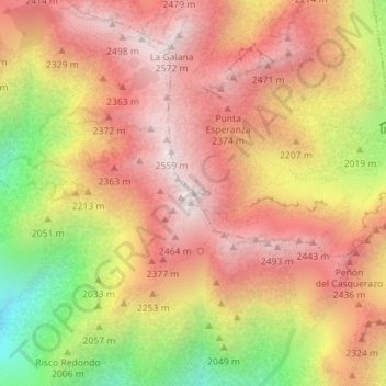
Name: Pico Almanzor topographic map, elevation, terrain.
Average elevation: 7,083 ft
Minimum elevation: 5,115 ft
Maximum elevation: 8,340 ft

Click on the map to display elevation.
Name: Pico Almanzor topographic map, elevation, terrain.
Average elevation: 7,083 ft
Minimum elevation: 5,115 ft
Maximum elevation: 8,340 ft