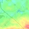
Wysoka topographic map
Click on the map to display elevation.
Wysoka
The oldest known mention Wysoka comes from 1260, when it was granted by Duke Bolesław the Pious from the Piast dynasty to Mikołaj Łodzia. Its name means "high" in Polish and refers to its elevation, as it is located at the Wysockie Hills. In the 15th century, there was already a Catholic church of St. Martin in the village. Wysoka was granted town rights in 1505. Also the town's coat of arms dates back to the 16th century. In the following centuries it was a private town owned by Polish nobility, particularly the Kościelski and Tuczyński families, located in the Kalisz Voivodeship in the Greater Poland Province of the Kingdom of Poland. In the late 17th century local noblewoman Apolonia Tuczyńska brought Augustinians to Wysoka. She later renewed Wysoka's town rights after a big fire in 1722, while in 1727–1729 the Augustinians built a Baroque Church of Our Lady of the Rosary.
About this map

Name: Wysoka topographic map, elevation, terrain.
Average elevation: 348 ft
Minimum elevation: 312 ft
Maximum elevation: 499 ft
Other topographic maps
Click on a map to view its topography, its elevation and its terrain.