
Feaster Park topographic map
Click on the map to display elevation.
About this map
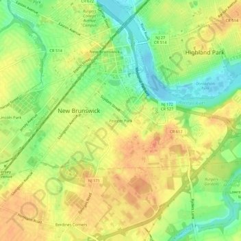
Name: Feaster Park topographic map, elevation, terrain.
Average elevation: 82 ft
Minimum elevation: -13 ft
Maximum elevation: 141 ft
Middlesex County trails, hiking, mountain biking, running and outdoor activities
Other topographic maps
Click on a map to view its topography, its elevation and its terrain.
Elmer B Boyd Park
United States > New Jersey > Middlesex County > New Brunswick > Feaster Park
Average elevation: 72 ft