Geolocate

Auchtertool topographic map

Click on the map to display elevation.

About this map

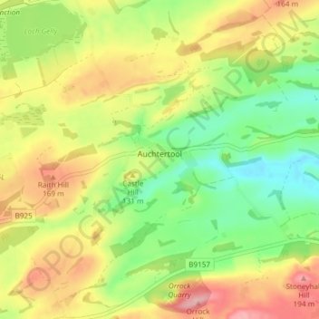
Name: Auchtertool topographic map, elevation, terrain.

Location: Auchtertool, Fife, Scotland, United Kingdom (56.08073 -3.28988 56.12218 -3.21749)

Average elevation: 371 ft

Minimum elevation: 151 ft

Maximum elevation: 633 ft

Other topographic maps

Click on a map to view its topography, its elevation and its terrain.

Anstruther

United Kingdom > Scotland > Fife

Average elevation: 75 ft

Auchtermuchty

United Kingdom > Scotland > Fife

Average elevation: 354 ft

Cupar

United Kingdom > Scotland > Fife

Average elevation: 246 ft

Rankeilour

United Kingdom > Scotland > Fife > Springfield

Average elevation: 157 ft

Leuchars

United Kingdom > Scotland > Fife > Leuchars

Average elevation: 72 ft

Crail

United Kingdom > Scotland > Fife

Average elevation: 69 ft

Gear up for your next adventure:

🎒Waterproof Dry Bags - Keep your electronics and maps dry inside your pack
🔌USB Car Charger - Car charger for on‑the‑go power needs
💧Water Filtration Bottles - Safely drink from streams and lakes while exploring
🌎3D Topographic Globes - Raised relief globes for a tactile understanding of geography
🪶Survival Guide Book - Expert advice for emergency preparedness

As an Amazon Associate, this site earns from qualifying purchases at no extra cost to you.