Geolocate

Scapezzano topographic map

Click on the map to display elevation.

About this map
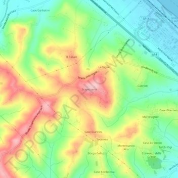
Name: Scapezzano topographic map, elevation, terrain.

Location: Scapezzano, Senigallia, Ancona, Marche, Italia (43.70005 13.14703 43.74005 13.18703)

Average elevation: 233 ft

Minimum elevation: -7 ft

Maximum elevation: 538 ft

Gear up for your next adventure:

🏫Relief Map Kits - Hands-on tools for teaching landforms and elevation
🔊Portable Camp Speaker - Music and alerts at camp
🎒Outdoor Daypacks - Lightweight backpacks designed for carrying maps and essential gear
🪶Wildlife Field Guides - Learn animal tracking and species ID
🧴Hand Sanitizer - Keep hands clean while hiking

As an Amazon Associate, this site earns from qualifying purchases at no extra cost to you.