
欧拉镇 topographic map
Interactive map
Click on the map to display elevation.
About this map
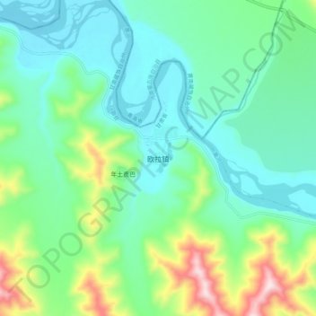
Name: 欧拉镇 topographic map, elevation, terrain.
Location: 欧拉镇, 玛曲县, 甘南藏族自治州, 甘肃省, 中国 (34.03654 101.68183 34.11654 101.76183)
Average elevation: 11,453 ft
Minimum elevation: 11,086 ft
Maximum elevation: 12,559 ft
Other topographic maps
Click on a map to view its topography, its elevation and its terrain.