
Cernache do Bonjardim, Nesperal e Palhais topographic map
Interactive map
Click on the map to display elevation.
About this map
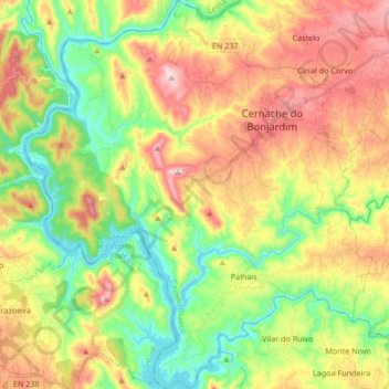
Name: Cernache do Bonjardim, Nesperal e Palhais topographic map, elevation, terrain.
Average elevation: 866 ft
Minimum elevation: 341 ft
Maximum elevation: 1,555 ft
Other topographic maps
Click on a map to view its topography, its elevation and its terrain.
Herdade
Portugal > Castelo Branco > Sertã
Herdade, Sertã, Castelo Branco, 6100-679, Portugal
Average elevation: 1,509 ft
Amioso
Portugal > Castelo Branco > Sertã
Amioso, Sertã, Castelo Branco, 6100-679, Portugal
Average elevation: 1,568 ft