
Cajabamba topographic map
Interactive map
Click on the map to display elevation.
About this map
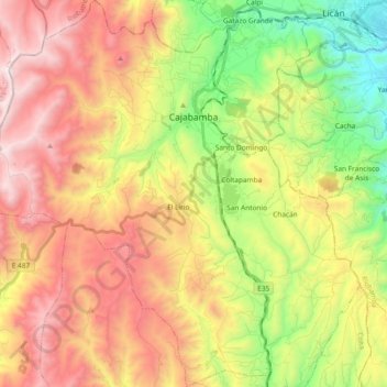
Name: Cajabamba topographic map, elevation, terrain.
Location: Cajabamba, Colta, Chimborazo, 060410, Ecuador (-1.83207 -78.87988 -1.64571 -78.71691)
Average elevation: 11,657 ft
Minimum elevation: 9,173 ft
Maximum elevation: 14,285 ft
Other topographic maps
Click on a map to view its topography, its elevation and its terrain.
Colta
Ecuador > Chimborazo > Colta > Cajabamba
Colta, Cajabamba, Colta, Chimborazo, 060410, Ecuador
Average elevation: 11,152 ft