Geolocate

Egan topographic map

Click on the map to display elevation.

About this map

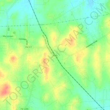
Name: Egan topographic map, elevation, terrain.

Location: Egan, Johnson County, Texas, United States (32.43292 -97.31974 32.47292 -97.27974)

Average elevation: 837 ft

Minimum elevation: 761 ft

Maximum elevation: 938 ft

Johnson County trails, hiking, mountain biking, running and outdoor activities

Other topographic maps

Click on a map to view its topography, its elevation and its terrain.

Joshua

United States > Texas > Johnson County

Average elevation: 883 ft

Cleburne

United States > Texas > Johnson County

Average elevation: 820 ft

Godley

United States > Texas > Johnson County

Average elevation: 942 ft

Rio Vista

United States > Texas > Johnson County

Average elevation: 719 ft

Grandview

United States > Texas > Johnson County

Average elevation: 676 ft

Gear up for your next adventure:

🔭Stargazing Telescopes - Perfect for camping in low-light pollution areas shown on maps
🧭GPS Watch Accessories - Bands and chargers for GPS watches
🧥Men's Rain Shells - Premium waterproof and breathable jackets for mountain weather
🪓Survival Multi‑Tool - Versatile tool for camp and trail tasks
🧷Carabiner Set - Durable clips for gear attachment

As an Amazon Associate, this site earns from qualifying purchases at no extra cost to you.