Geolocate

Capinota topographic map

Click on the map to display elevation.

About this map
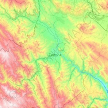
Name: Capinota topographic map, elevation, terrain.

Location: Capinota, Cochabamba, Bolivia (-17.95172 -66.39383 -17.47259 -66.10737)

Average elevation: 10,069 ft

Minimum elevation: 7,175 ft

Maximum elevation: 14,573 ft

Other topographic maps

Click on a map to view its topography, its elevation and its terrain.
Cochabamba

Bolivia > Cochabamba > Cercado > Cochabamba

Average elevation: 10,318 ft

Gear up for your next adventure:

🏔️Mountain Trail Maps - High‑detail maps for popular peaks
📡Handheld GPS Device - Reliable handheld GPS for outdoor navigation
🧴Hand Sanitizer - Keep hands clean while hiking
🧭Compass with Lanyard - Easy‑carry compass for navigation
🔥Plasma Lighters - Windproof lighters that work in any weather condition

As an Amazon Associate, this site earns from qualifying purchases at no extra cost to you.