
Thank you for supporting this site ❤️
Make a donation
Make a donation
Gear up for your next adventure:
As an Amazon Associate, this site earns from qualifying purchases at no extra cost to you.
Vien topographic map
Click on the map to display elevation.
Thank you for supporting this site ❤️
Make a donation
Make a donation
Gear up for your next adventure:
As an Amazon Associate, this site earns from qualifying purchases at no extra cost to you.
About this map
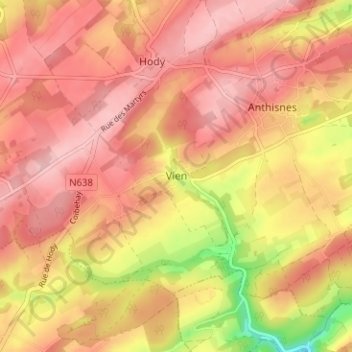
Name: Vien topographic map, elevation, terrain.
Location: Vien, Anthisnes, Huy, Liège, Wallonie, 4160, Belgique (50.45385 5.48536 50.49385 5.52536)
Average elevation: 807 ft
Minimum elevation: 469 ft
Maximum elevation: 965 ft
Thank you for supporting this site ❤️
Make a donation
Make a donation
Gear up for your next adventure:
As an Amazon Associate, this site earns from qualifying purchases at no extra cost to you.