
Thank you for supporting this site ❤️
Make a donation
Make a donation
Gear up for your next adventure:
As an Amazon Associate, this site earns from qualifying purchases at no extra cost to you.
Riale topographic map
Click on the map to display elevation.
Thank you for supporting this site ❤️
Make a donation
Make a donation
Gear up for your next adventure:
As an Amazon Associate, this site earns from qualifying purchases at no extra cost to you.
About this map
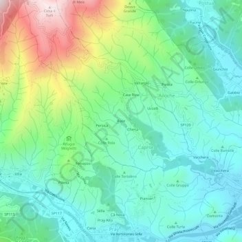
Name: Riale topographic map, elevation, terrain.
Location: Riale, Caprile, Biella, Piemonte, 13861, Italia (45.67408 8.19038 45.71408 8.23038)
Average elevation: 1,969 ft
Minimum elevation: 1,257 ft
Maximum elevation: 3,819 ft
Thank you for supporting this site ❤️
Make a donation
Make a donation
Gear up for your next adventure:
As an Amazon Associate, this site earns from qualifying purchases at no extra cost to you.