
Thank you for supporting this site ❤️
Make a donation
Make a donation
Gear up for your next adventure:
As an Amazon Associate, this site earns from qualifying purchases at no extra cost to you.
Weckerath topographic map
Click on the map to display elevation.
Thank you for supporting this site ❤️
Make a donation
Make a donation
Gear up for your next adventure:
As an Amazon Associate, this site earns from qualifying purchases at no extra cost to you.
About this map
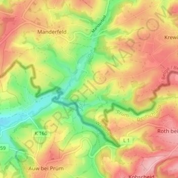
Name: Weckerath topographic map, elevation, terrain.
Location: Weckerath, Büllingen, Verviers, Luik, Wallonië, België (50.29815 6.33313 50.33815 6.37313)
Average elevation: 1,739 ft
Minimum elevation: 1,486 ft
Maximum elevation: 1,962 ft
Thank you for supporting this site ❤️
Make a donation
Make a donation
Gear up for your next adventure:
As an Amazon Associate, this site earns from qualifying purchases at no extra cost to you.