Geolocate

Aston topographic map

Click on the map to display elevation.

About this map
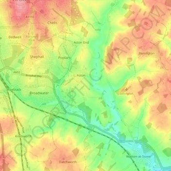
Name: Aston topographic map, elevation, terrain.

Location: Aston, East Hertfordshire, Hertfordshire, England, United Kingdom (51.85320 -0.16118 51.91547 -0.12087)

Average elevation: 325 ft

Minimum elevation: 171 ft

Maximum elevation: 469 ft

Other topographic maps

Click on a map to view its topography, its elevation and its terrain.
Gear up for your next adventure:

🧥Waterproof Jacket for Hiking - Breathable and rugged rain jacket for outdoor excursions
🧥Men's Rain Shells - Premium waterproof and breathable jackets for mountain weather
🛠️Outdoor Gear Repair Kit - Essential tools to fix gear on the trail
🌐World Map Poster - Decorative world maps with topographic info
🪶Multi‑Purpose Knife - Useful blade for camp and trail

As an Amazon Associate, this site earns from qualifying purchases at no extra cost to you.