Geolocate

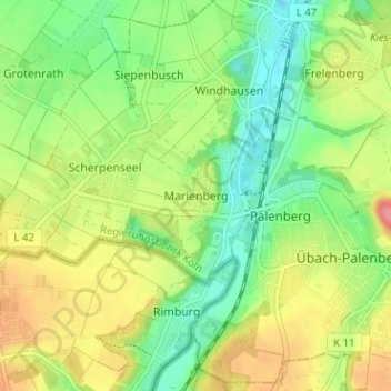
Marienberg topographic map

Click on the map to display elevation.

Marienberg

Marienberg ligt in het dal van de Worm op een hoogte van ongeveer 115 meter. In het oosten ligt deze rivier, geflankeerd door het Naherholungsgebiet Wurmtal, een natuur- en recreatiegebied.

Wikipedia (CC-BY-SA 3.0)

About this map

Name: Marienberg topographic map, elevation, terrain.

Location: Marienberg, Übach-Palenberg, Kreis Heinsberg, Noordrijn-Westfalen, 52531, Duitsland (50.90760 6.06755 50.94760 6.10755)

Average elevation: 361 ft

Minimum elevation: 243 ft

Maximum elevation: 518 ft

Gear up for your next adventure:

🥾Men's Hiking Boots - Durable, waterproof footwear for rugged terrain and steep inclines
🍳Camping Cook Set - Complete cookware for outdoor meals
🏕️Family Camping Gear - Essentials for group camping trips
⌚GPS Sports Watch - GPS watch for running, hiking and training
📶Vehicle Signal Boosters - Improve reception in rural areas while driving to trailheads

As an Amazon Associate, this site earns from qualifying purchases at no extra cost to you.