
Thank you for supporting this site ❤️
Make a donation
Make a donation
Gear up for your next adventure:
As an Amazon Associate, this site earns from qualifying purchases at no extra cost to you.
Attabad lake topographic map
Click on the map to display elevation.
Thank you for supporting this site ❤️
Make a donation
Make a donation
Gear up for your next adventure:
As an Amazon Associate, this site earns from qualifying purchases at no extra cost to you.
About this map
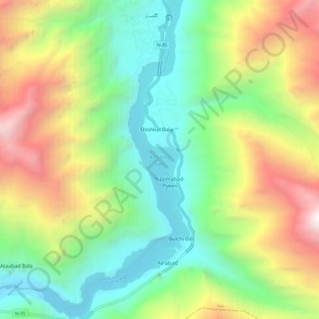
Name: Attabad lake topographic map, elevation, terrain.
Location: Attabad lake, Bulchi Dās, Gilgit-Baltistan, Pakistan (36.29980 74.82075 36.39217 74.87646)
Average elevation: 11,158 ft
Minimum elevation: 7,595 ft
Maximum elevation: 17,441 ft
Thank you for supporting this site ❤️
Make a donation
Make a donation
Gear up for your next adventure:
As an Amazon Associate, this site earns from qualifying purchases at no extra cost to you.