Geolocate

Huaran topographic map

Click on the map to display elevation.

About this map
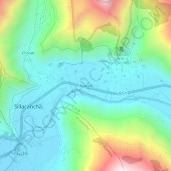
Name: Huaran topographic map, elevation, terrain.

Location: Huaran, Arin, Calca, Province of Calca, Cusco, 08471, Peru (-13.33081 -72.03905 -13.29081 -71.99905)

Average elevation: 10,469 ft

Minimum elevation: 9,429 ft

Maximum elevation: 13,146 ft

Gear up for your next adventure:

📡GPS Antenna Upgrade - Enhance GPS reception in remote terrain
📦Dry Bags Set - Waterproof storage for electronics and clothes
🔦Powerful Headlamps - Ultra-bright hands-free lighting for night navigation
🏫Relief Map Kits - Hands-on tools for teaching landforms and elevation
🧭Pro Hiking Compasses - High-accuracy liquid-filled compasses for topographic orientation

As an Amazon Associate, this site earns from qualifying purchases at no extra cost to you.