
Make a donation
Gear up for your next adventure:
As an Amazon Associate, this site earns from qualifying purchases at no extra cost to you.
Praia do Gunga topographic map
Click on the map to display elevation.
Make a donation
Gear up for your next adventure:
As an Amazon Associate, this site earns from qualifying purchases at no extra cost to you.
Praia do Gunga
A vila de Maceió foi desmembrada no dia 5 de dezembro de 1815 da então Vila de Santa Maria Madalena da Alagoa do Sul, ou simplesmente Vila de Alagoas, atual cidade de Marechal Deodoro. Em 9 de dezembro de 1839, deu-se a elevação à condição de cidade, principalmente por causa do desenvolvimento advindo da operação do porto de Jaraguá, um porto natural que facilitava o atracamento de embarcações, por onde eram exportados açúcar, tabaco, coco e especiarias. Em 16 de dezembro de 1839, é inaugurado o município de Maceió, sendo seu primeiro intendente Augustinho da Silva Neves.
Make a donation
Gear up for your next adventure:
As an Amazon Associate, this site earns from qualifying purchases at no extra cost to you.
About this map
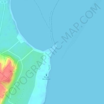
Name: Praia do Gunga topographic map, elevation, terrain.
Average elevation: 20 ft
Minimum elevation: -7 ft
Maximum elevation: 226 ft
Make a donation
Gear up for your next adventure:
As an Amazon Associate, this site earns from qualifying purchases at no extra cost to you.