
Make a donation
Gear up for your next adventure:
As an Amazon Associate, this site earns from qualifying purchases at no extra cost to you.
Ketelhaven topographic map
Click on the map to display elevation.
Make a donation
Gear up for your next adventure:
As an Amazon Associate, this site earns from qualifying purchases at no extra cost to you.
About this map
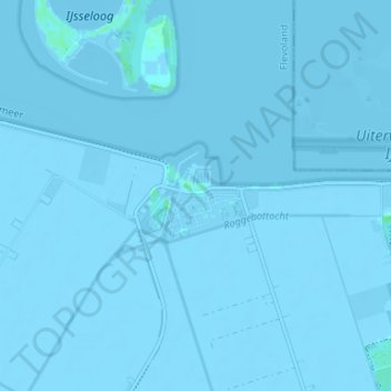
Name: Ketelhaven topographic map, elevation, terrain.
Location: Ketelhaven, Dronten, Flevoland, Nederland, 8253 AG, Nederland (52.55815 5.74142 52.59815 5.78142)
Average elevation: -10 ft
Minimum elevation: -20 ft
Maximum elevation: 16 ft
Make a donation
Gear up for your next adventure:
As an Amazon Associate, this site earns from qualifying purchases at no extra cost to you.
Other topographic maps
Click on a map to view its topography, its elevation and its terrain.
Make a donation
Gear up for your next adventure:
As an Amazon Associate, this site earns from qualifying purchases at no extra cost to you.
Ketelmeer
Nederland > Flevoland > Dronten
In het Ketelmeer zijn twee betonde vaargeulen geschikt voor schepen tot en met CEMT-klasse Va. De toegestane afmeting van vaartuigen algemeen zijn 200 meter lang, 17½ meter breed en 2,6 meter diepgang. De maximale hoogte is 30,4 meter (wegens de hoogspanninglijn Lelystad - Ens).
Average elevation: -10 ft
Make a donation
Gear up for your next adventure:
As an Amazon Associate, this site earns from qualifying purchases at no extra cost to you.