Geolocate

Rayos del Sol topographic map

Click on the map to display elevation.

About this map

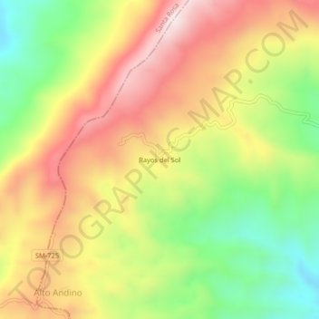
Name: Rayos del Sol topographic map, elevation, terrain.

Location: Rayos del Sol, Cuñumbuqui, Lamas, San Martín, Perú (-6.67364 -76.56294 -6.63364 -76.52294)

Average elevation: 3,386 ft

Minimum elevation: 2,405 ft

Maximum elevation: 4,341 ft

Gear up for your next adventure:

📚USA Hiking Guide Books - Top trail guides and map books
🧯Portable Fire Pit - Compact fire pit for camping spots
🎒Waterproof Dry Bags - Keep your electronics and maps dry inside your pack
📱Solar Portable Charger - Solar power bank for charging devices off‑grid
🧼Biodegradable Camping Soap - Eco‑friendly soap for outdoor hygiene

As an Amazon Associate, this site earns from qualifying purchases at no extra cost to you.