Geolocate

Pulucate topographic map

Click on the map to display elevation.

About this map

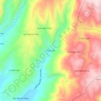
Name: Pulucate topographic map, elevation, terrain.

Location: Pulucate, Columbe, Colta, Chimborazo, Ecuador (-1.86138 -78.72400 -1.82138 -78.68400)

Average elevation: 10,965 ft

Minimum elevation: 10,358 ft

Maximum elevation: 11,611 ft

Gear up for your next adventure:

🧭Orienteering Set - Complete compass and map reading kit
👓Polarized Sunglasses - Outdoor sunglasses for glare reduction
🧣Hiking Neck Gaiter - Multi‑use neck protection for outdoor weather
🧤Hiking Gloves - Protective gloves for rugged trails
🧥Waterproof Jacket for Hiking - Breathable and rugged rain jacket for outdoor excursions

As an Amazon Associate, this site earns from qualifying purchases at no extra cost to you.