
Thank you for supporting this site ❤️
Make a donation
Make a donation
Gear up for your next adventure:
As an Amazon Associate, this site earns from qualifying purchases at no extra cost to you.
Lienisberg topographic map
Click on the map to display elevation.
Thank you for supporting this site ❤️
Make a donation
Make a donation
Gear up for your next adventure:
As an Amazon Associate, this site earns from qualifying purchases at no extra cost to you.
About this map
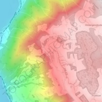
Name: Lienisberg topographic map, elevation, terrain.
Location: Lienisberg, Walchwil, Zug, 6318, Switzerland (47.11431 8.50866 47.13431 8.52866)
Average elevation: 2,595 ft
Minimum elevation: 1,329 ft
Maximum elevation: 3,327 ft
Thank you for supporting this site ❤️
Make a donation
Make a donation
Gear up for your next adventure:
As an Amazon Associate, this site earns from qualifying purchases at no extra cost to you.